¿Tiene planes para visitar nuestro país esta primavera o verano?
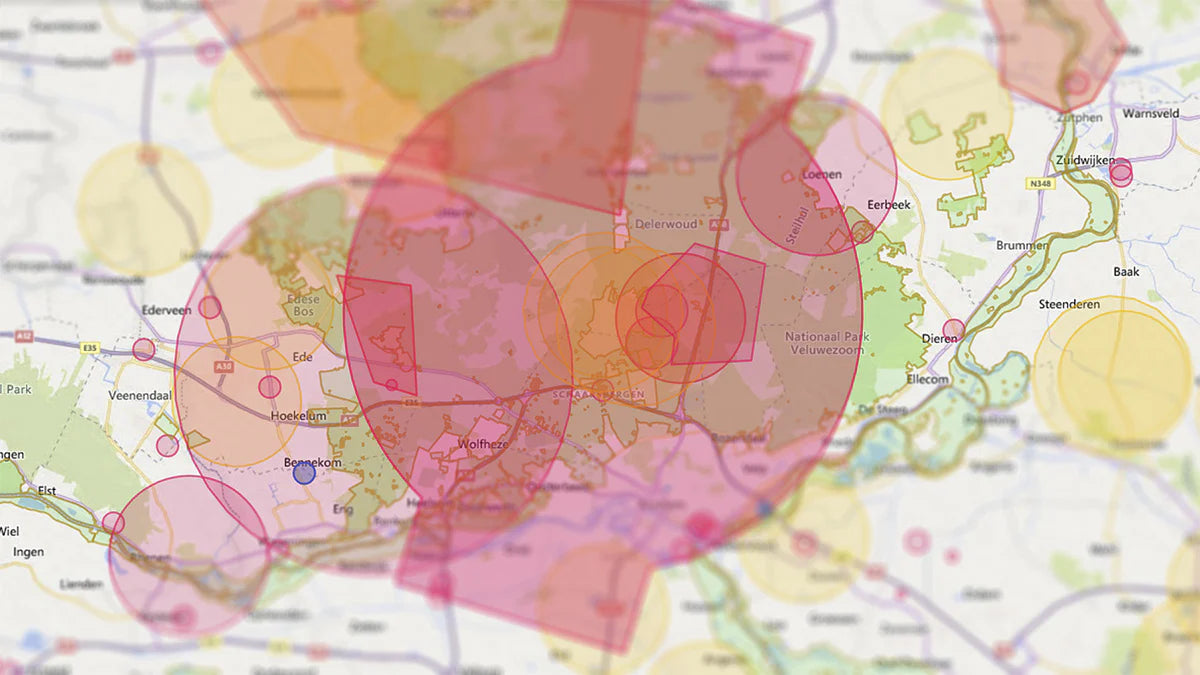
El mapa de drones de los Países Bajos muestra las distintas zonas del espacio aéreo holandés. Antes de empezar a volar tu dron, debes comprobar en qué zona quieres volar y si está permitido el vuelo de drones. Las diferentes zonas se muestran por ubicación en el mapa de drones, incluidas las zonas de prohibición de vuelo.
¡Evite multas en sus vacaciones! Veamos dónde puedes y dónde no puedes volar.
¿Dónde está permitido volar drones en los Países Bajos?
Dónde puede volar su dron depende del espacio aéreo y de las restricciones existentes. El mapa de drones de los Países Bajos muestra todas las restricciones para cada lugar. Hay varios mapas de drones de los Países Bajos. Recomendamos el mapa para drones de GoDrone. Este mapa de drones procede del Control del Tráfico Aéreo de los Países Bajos y también indica todas las zonas temporales de exclusión aérea.
GoDrone tiene una aplicación móvil que se puede descargar gratuitamente. Tanto la aplicación como el sitio web pueden mostrar tu ubicación actual. También se puede introducir una dirección, tras lo cual se mostrarán todas las restricciones de la dirección introducida.

Leyenda del mapa de drones de los Países Bajos
En el mapa de drones de los Países Bajos están marcadas diferentes zonas. Cada zona tiene su propio significado y normas. En algunas zonas está prohibido volar un dron y en otras se aplican advertencias.
Zonas no marcadas
Las zonas no marcadas también se conocen como espacio aéreo abierto. Como piloto de drones, es libre de volar aquí, siempre que cumpla las normas europeas sobre drones.
Zonas de exclusión aérea (zonas rojas)
Las zonas de prohibición de vuelo se muestran en los mapas de drones de los Países Bajos como zonas rojas. Encontrarás estas zonas de prohibición de vuelo alrededor de aeropuertos y bases militares. En ellas no está permitido volar drones.
Zonas temporales de prohibición de vuelo (zonas azules)
Una zona temporal de prohibición de vuelo se muestra como un área azul en el mapa de drones de los Países Bajos. Una zona de exclusión aérea temporal es un área en la que se están llevando a cabo actividades aéreas, lo que prohíbe temporalmente volar drones en ella. Al hacer clic en una zona azul del mapa de drones, se abre una descripción. Esta descripción muestra cuándo está activa la zona temporal de prohibición de vuelo.
Natura 2000 (zonas verdes)
Las zonas verdes del mapa de drones son zonas Natura 2000. Se trata de reservas naturales protegidas, donde no se debe molestar a los animales. Si quiere volar en una zona Natura 2000, necesita permiso del guarda forestal y de la provincia (estado) propietaria del terreno.
Zonas de bajo vuelo (zonas naranjas)
Las zonas de bajo vuelo se muestran como zonas naranjas. Está permitido volar con drones en estas zonas si vas acompañado de un observador. El trabajo del observador consiste en vigilar la zona y alertar al piloto cuando se aproxime tráfico aéreo. Si se divisan otros vehículos aéreos, el piloto debe iniciar inmediatamente el aterrizaje. Como piloto de drones, debes ceder el paso a todos los demás tipos de vehículos de aviación.
Aquí sólo pueden volar drones de las subcategorías A1 y A2. Mantenga una altura máxima de 30 metros.
Advertencia (zonas amarillas)
En las zonas amarillas se aplica una advertencia. En dichas zonas puede entrar en contacto con otros vehículos aéreos. En las zonas amarillas, se recomienda llevar un observador con usted para vigilar la zona y alertar al piloto. Cuando se avise a otro tráfico aéreo, el piloto del dron debe ceder el paso.
¿Busca mapas de drones de otros países europeos? Consulte el blog con mapas de drones de Europa.
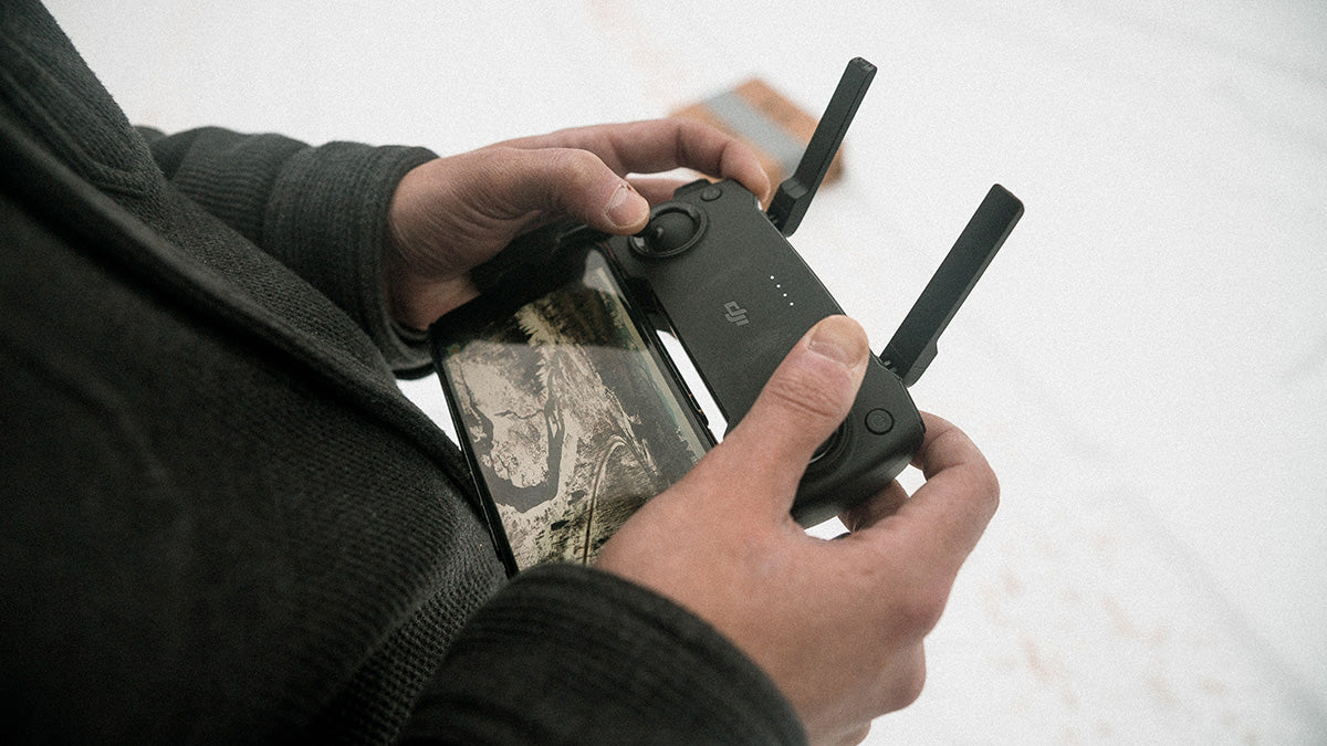
¿Necesito una licencia de la UE para volar un dron?
¿Quiere volar un dron en los Países Bajos? Si es así, necesita una Licencia UE para drones a partir de 250 gramos. Si su dron pesa más de 249 gramos, deberá obtener una Licencia UE para drones. La Licencia UE para drones le permite volar en espacio aéreo abierto. La licencia europea para drones se obtiene realizando un curso de formación en línea y un examen en línea. Una vez aprobado, nos envía su solicitud para obtener el certificado. Una vez completada la solicitud, recibirá la licencia de dron de la UE por correo electrónico en cuestión de minutos. Con la licencia de dron de la UE podrá volar en el espacio aéreo abierto de toda Europa.
¿Por qué obtener su licencia de drones de la UE en Drone Class?
Razones para elegirnos como su escuela de vuelo:
- Formación online completa en un número limitado de horas
- Tasa de éxito del 95% (al primer intento)
- Examen online y repeticiones gratuitas
- Certificado expedido por las autoridades holandesas (RDW) y reconocido por la agencia europea EASA
¿Tiene alguna pregunta sobre el mapa de drones de los Países Bajos o qué certificado debe obtener para su dron? Póngase en contacto con nosotros.

Share:
Normas sobre drones en 2023
Vista previa: DJI Mavic 3 Pro