
The 120-meter rule also applies in the mountains, but it’s measured from the nearest point on the Earth’s surface. So you can fly up along the slope: at a 3,000-meter peak, you can still fly 120 meters above the ground. The real challenges in the mountains aren’t the rules, but the physics: thin air, cold, unpredictable winds, and a return-to-home function that can send your drone straight into a mountainside if you set it up incorrectly.
In this guide, you’ll learn how to fly safely and legally in the mountains and how to return home with footage that made the trip worthwhile.
Maximum flight altitude in the mountains
The European drone regulation states: a maximum of 120 meters above the nearest point on the Earth’s surface. Not above sea level and not above your takeoff point. If you’re flying up a slope, your maximum altitude increases with the terrain. If you’re at 2,400 meters, you may fly 120 meters above the ground there, even if that’s 2,520 meters above sea level.
If you’re flying from a peak or a ridge into a valley, the distance to the nearest point on the Earth’s surface still applies—and that could be the mountainside right next to you. If you stay close to the slope, you’re within the legal limits. If you fly far out over the open valley, there’s suddenly 400 meters of air beneath your drone, and you’ll be well above the limit. Rule of thumb: keep the slope within 120 meters of your drone, horizontally or vertically.
Also, pay attention to your flight app: the altitude on your screen is measured from your starting point, not from the terrain beneath the drone. If you take off from a parking lot in the valley and fly up a slope, your screen might show 300 meters even though you’re actually hovering a mere 60 meters above the ground. The reverse is also true: the screen may reassure you while the terrain below you is actually dropping away.

What to Watch Out For When Flying a Drone in the Mountains
Above 2,000 meters, your drone will notice the altitude before you do. The air is thinner there, so the propellers have less grip and the motors have to work harder to generate the same lift. On top of that, it’s almost always colder in the mountains.
|
Effect |
What you’ll notice |
Solution |
|
Thin air |
Difficulty taking off or climbing, less reserve during gusts of wind, higher power consumption |
Fly more smoothly, allow for extra battery margin, do not fly above the maximum takeoff altitude the drone can handle |
|
Cold |
Battery capacity drops rapidly, voltage dips, sudden percentage drops |
Carry batteries in your inner pocket; install them just before the flight; after takeoff, hover for 30 to 60 seconds to allow the battery to reach operating temperature |
|
Shorter flight time |
Expect 20 to 30 percent less flight time than at sea level |
Return when the battery is at 40 percent instead of 25 percent; always start flying into the wind so you have a tailwind on the return trip |
|
Signal loss |
The connection is lost as soon as a ridge or rock comes between you and the drone |
Maintain line of sight (VLOS is mandatory anyway), never fly behind a ridge, check RTH settings in advance |
In addition, there are specific obstacles you need to watch out for.
Não sabe qual a licença de que precisa?
What to keep in mind in the mountains
These are the key points to consider:
- Cable cars and lifts. Cables are virtually invisible to obstacle sensors and hang at exactly the altitudes where you want to fly. Keep a safe distance from any lift.
- Rescue helicopters fly low and without warning. If you hear or see a helicopter, land immediately. In many Alpine countries, there is a strict ban on all other air traffic during a rescue operation.
- Paragliders and gliders share the airspace with you. Popular hiking areas are often also paragliding areas. They (and all other air traffic) always have the right of way.
- National parks are usually off-limits. Many of the most beautiful areas are protected nature reserves where drones are not allowed to fly, or may only do so with a special permit. Check the local drone map for each country before departure and respect wildlife zones: a drone that startles wild animals sets a bad example. Birds of prey view drones as intruders and will attack.
- Ski resorts almost always prohibit drones. If you’re visiting in the winter, expect the lift operator to ban drones on the slopes through its rules and regulations. Fly outside the ski resort, far from the lifts, and if in doubt, ask the resort manager.

Rules by Mountain Country at a Glance
|
País |
Licença de Drone da UE |
Details |
|
Áustria |
Valid |
Check the Dronespace map from Austro Control; many nature reserves around popular hiking areas |
|
Suíça |
Valid |
Not an EU member but follows European drone regulations; has its own map and registration through the Swiss Federal Office of Civil Aviation |
|
França |
Valid |
National parks (such as the Vanoise and the Ecrins) are strictly off-limits; check the Géoportail map |
|
Itália |
Valid |
d-flight map; the Dolomites are partly located in protected areas with their own rules |
|
Noruega |
Valid |
As an EASA country, follows European rules; fjord areas have local restrictions and many bird sanctuaries |
Your EU Drone License covers all these countries. The differences lie in the maps and nature reserves. Check the official drone map for each country and don’t forget your operator number.
Here you can find the official drone maps for all EU countries.
The three shots that make the mountains worth visiting
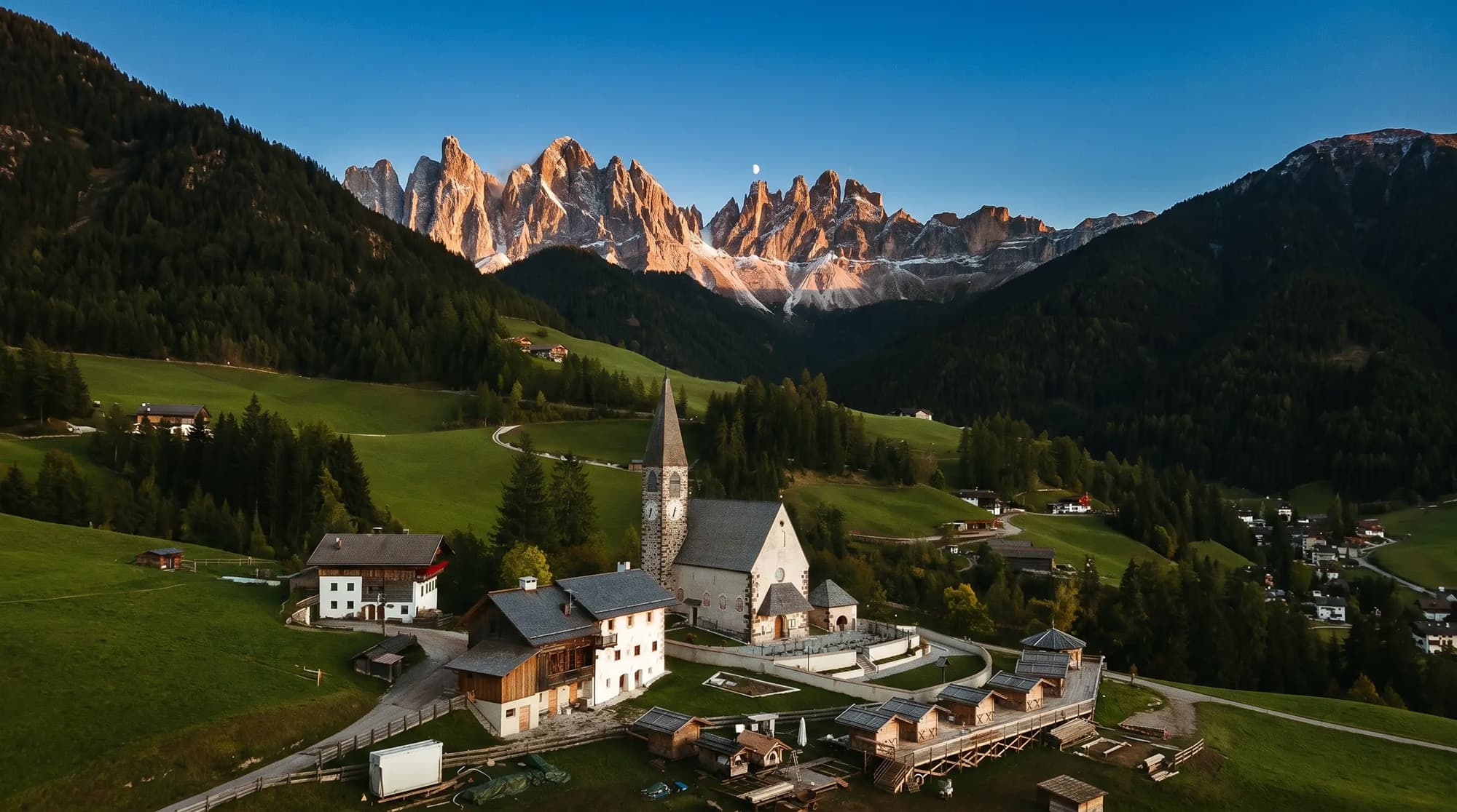
Alpenglow on the peaks. In the quarter-hour after sunset, the highest peaks turn deep pink while the valley is already blue. Expose for the peaks and let the valley remain dark.
Tiny person. Capture your travel companion in miniature, framed by the vast emptiness on either side. Fly sideways at ridge height, maintain a distance of 30 meters, and position the person on the third line.
Layered morning fog. Getting up early pays off: banks of fog fill the valley, and the peaks pierce through them. Fly just above the fog layer and shoot against the light to create depth.
Find more inspiration in our guide featuring the 10 most beautiful vacation shots.

Frequently Asked Questions
How high can you fly a drone in the mountains?
A maximum of 120 meters above the nearest point on the Earth’s surface. On a slope, the maximum flight altitude rises along with the terrain. If you’re flying from a peak down into a valley, the distance to the nearest terrain is what counts, so stay close to the slope.
Can I fly my drone on a 3,000-meter mountain?
Yes. The 120-meter rule refers to altitude above the ground, not above sea level. Be sure to check your drone’s maximum takeoff altitude: consumer drones typically have a limit between 3,000 and 6,000 meters above sea level, which you can find in the specifications.
Does a drone work at high altitudes?
Yes, but with limitations. The air is thinner, causing the motors to work harder, flight time decreases by 20 to 30 percent, and the drone reacts more slowly to gusts of wind. Allow for extra battery capacity and stay below the maximum takeoff altitude listed in the specifications.
Is my EU drone license valid in Switzerland and Norway?
Yes. Neither country is an EU member, but they follow European drone regulations, so your EU drone license is valid there. They do have their own drone maps and registration procedures, so be sure to check those before you leave.
Can you bring a drone to a ski resort?
You’re allowed to bring one, but virtually all ski resorts prohibit drones on and around the slopes in their rules, and the ski lifts also make it dangerous. Fly outside the ski resort, far away from lifts and people.
What is the biggest danger when flying a drone in the mountains?
The combination of wind and an incorrectly set return-to-home (RTH) function. Wind accelerates on ridges and pushes your drone down on the leeward side, and if you lose the signal, RTH will fly in a straight line back home—possibly through a mountain face. Reset the RTH altitude for each flight above the highest obstacle.
Be prepared before flying in the mountains
Flying a drone in the mountains can yield beautiful footage. Those who understand the rules, the wind, and their batteries will return home with footage that’s impossible to capture in the Netherlands. You lay that foundation with the EU Drone License: valid in 30 European countries, including Switzerland and Norway. Drone Class is recognized by RDW and EASA; over 75,000 pilots have completed the course before you, with a 4.9 rating from over 3,300 reviews and a 95% first-time pass rate.
Want to take your mountain photography to the next level? With Drone Class Plus, you’ll get monthly photography workshops and feedback on your own work.